BY GEORGE FRIEDMAN
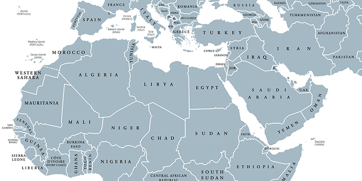
From a geographic standpoint, the Middle East and North Africa region extends from the Atlantic Ocean in the west to the Indian Ocean in the east, and from Turkey in the north to Yemen in the south.
The bulk of the region is situated along five waterways: the Mediterranean Sea, Red Sea, Persian Gulf, Black Sea, and Caspian Sea.
Let’s look at the five maps below that give a big-picture view of the region, as well as the forces that underlie its geopolitics.
Map of the Middle East and North Africa #1: Population Density
As the first map below shows, a key feature of the Middle East is that much of it is sparsely populated.
This is largely due to the desert conditions.
People in North Africa largely reside just south of the Mediterranean coast. The bulk of Egypt’s nearly 90 million people inhabit the areas around the Nile River.
Most of the people in the Middle East live in the region’s northern rim that runs from Iran through Iraq to Syria and into Turkey.
Map of the Middle East and North Africa #2: Arab-Speaking Population
The Arab-majority Middle East represents the core of the Muslim world.
The map below shows the extent of the spread of Arabic-speaking populations in the region. This also reflects the spread of Islam.
Founded in 610 AD in the city of Mecca on the west coast of modern-day Saudi Arabia, Islam covered the entire Arabian Peninsula along with the Levant. It also crossed the Persian Gulf into Mesopotamia and Persia.
At the same time, Islam advanced east into Egypt and from there, across the North African coast up to modern-day Morocco. The last destination served as a launch pad to cross into the Iberian Peninsula.
Map of the Middle East and North Africa #3: The Ottoman Empire
Arabs dominated many of these lands—save for Persia and Anatolia, which accepted Islam but retained their unique ethno-linguistic traits.
Anatolia only became part of the Middle East due to the Ottoman conquest of the region in the early 16th century (see the map below).
Otherwise, the Arabs under both the Umayyad (661–749) and Abbasid (749–1258) dominions were unsuccessful in seizing lands from the Byzantines north of the Levant.
While the Arabs were able to push into the Caucasus and Central and South Asia, Persian resurgence in the form of the Safavid Empire in the early 1500s limited Arab control beyond modern-day Iran.
Turkic peoples of various sorts who converted to Islam controlled the areas north and northeast of the Middle East.
It should be noted that the term “Middle East” was coined in the early 20th century. Prior to that, the region was called the “Near East.” Despite the fact that the term Middle East has become ubiquitous, the United States government and academia still refer to it as the Near East.
Map of the Middle East and North Africa #4: Artificial Borders
The current borders of the region were largely drawn up by the British and French in the aftermath of World War I and in the wake of the implosion of the Ottoman Empire.
However, the region was extremely divided prior to the Ottoman conquest in the first quarter of the 16th century going all the way back to the late ninth century, when the Abbasid dynasty began declining.
Map of the Middle East and North Africa #5: Cultural Divisions
Many competing caliphates, sultanates, and emirates ruled different parts of this region. Therefore, the many ethnic, sectarian, tribal, and ideological fault lines today are not simply the outcome of the present nation-state era.
In Shambles
As it stands today, the Arab core of the Middle East has hollowed out, with non-Arab polities dominating the region. The four major powers in the region are (in order of decreasing power) Turkey, Israel, Iran, and Saudi Arabia.
The Saudi kingdom is the only Arab power remaining after the so-called Arab Spring, and it too isn’t doing well given its inherent weakness and the fact that it shoulders the responsibility of (Sunni) Arab regional security.
For the most part, the region’s Arab states are devolving into non-state actors.
This situation allows the proliferation of jihadist groups. Iran and its Arab Shiite allies are also trying to take advantage of the growing chaos in the region to expand their geopolitical sectarian interests.
Meanwhile, Turkey is trying to reassert itself in the areas previously occupied by the Ottoman Empire. Elsewhere, the only non-Muslim power in the region, Israel, is trying to manage the emerging anarchy on all of its borders.
The World Explained in Maps reveals the panorama of geopolitical landscapes influencing today's governments and global financial systems. Don't miss this chance to prepare for the year ahead with the straight facts about every major country’s and region's current geopolitical climate. You won't find political rhetoric or media hype here.
The World Explained in Maps is an essential guide for every investor as 2017 takes shape. Get your copy now—free!